Canada part 4 – into the Yukon northbound to Ross River and Carmacks

Brown colored bear but but possibly a black bear
A black bear and a fat brown colored bear greeted me into the Yukon as I headed north on the Robert Campbell Highway. I took that as a good omen. There were also 3 bears near Contact Creek which is on a short piece of highway that runs along the border with British Columbia. Contact Creek pic below.

Contact Creek
The Yukon fascinates me ! Northbound out of Watson Lake to Ross River on HWY 4 the Robert Campbell.
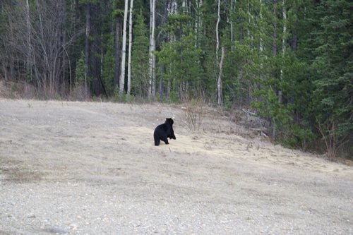
black bear running into the trees
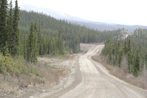
This is a mining road which is still under construction. I took it very slow because the washboard surface was shaking me apart. I saw two bears straight away and a large wolf later but there was no other large wildlife that i noticed that I noticed up to Ross River.
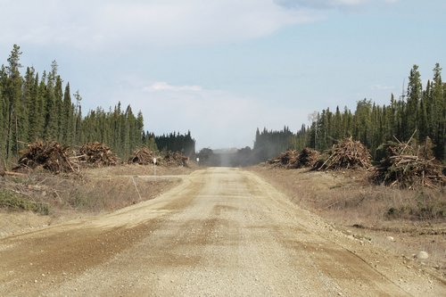
Robert Campbell Highway under construction
Robert Campbell Highway 4 northbound out of Watson Lake to the village of Ross River, Yukon. The Brown bear below is the same one in picture 1 above.

Brown bear in birch trees on Yukon Highway 4
A large part of Highway 4 was under construction and I really did not see much traffic except for 3 mining trucks pulling triple trailers. A big wolf happened to be crossing the road right in front of me and kept pace for about 100 meters before veering off into the brush on the other side. I very rarely see wolves from the highway so this was pretty cool to me!

Ross River
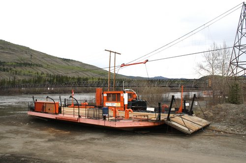
Ross River village. This was the day before the holiday Victoria Day so nothing was open and I could not get my card to work at the card lock gas pump. There is a ferry across the Pelly River that was not in operation but you can continue on Highway all the way to the border of the Northwest Territory.
Pelly River ferry in Ross River village
That road is closed in the winter but you can pick up the Canol Heritage Trail in the NWT that leads up the the Mackenzie River by Normal Wells. That trail is in a remote location and only experienced people should consider doing it as it is among the most challenging in Canada.
Pelly barge ferry
Pelly River crossing ferry in Ross River town.

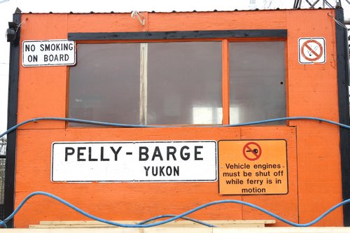
warning sing
Pelly River barge – make arrangements in advance with the ferry people because there is no regular ferry schedule. I suspect that remote mines use this ferry to get their equipment across the river. I didn’t get a chance to ask anyone about that.

Ross River trapper drying beaver pelts on the side of his house.
Local beaver trapper from Ross River drying beaver pelts.

Ross River crew
The local crew invited me over for a bit.

Ross River road
It was Victoria Day the next day on Monday and everyone was chilling out.
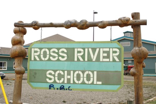
Ross River School
Yukon College places a lot of emphasis on teaching mining technology.
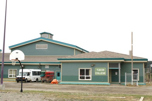
Yukon College
Looks like I wasn’t going to be able to get any gasoline in Ross River until the afternoon so I headed out west towards Carmacks.

Road sign
Carmacks bound
HWY 4
really like this picture – this is the sort of thing that I am always searching for

snow machine
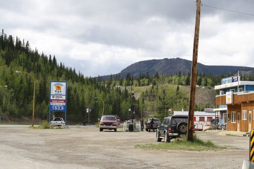
Carmacks – the store – Sunrise Gas – where I got more gas allowed me to charge up my camera batteries free – wow – fantastic ! ( gas – 153.9 liter )
Carmacks
Heading north towards Dawson City and the Arctic Circle.

northbound
Pelly Crossing – north of Minto

bridge
Canada road trip part 4 Canada road
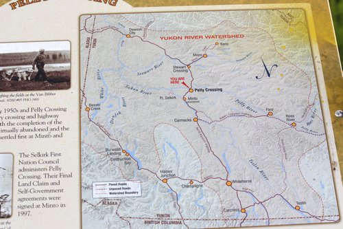
map Pelly Crossing
Porcupine
![]() trip part 4 – Yukon Territory – Robert Campbell Highway – Ross River – Carmacks
trip part 4 – Yukon Territory – Robert Campbell Highway – Ross River – Carmacks
 Climbing Mount Apo
 General Santos
 Growing Orchids
 Judy's Resto Bar
 Logging with Motorcycles
 Mount Mayon
 Balabac Island
 Biri Island
 Calbiga Cave
 Capul Island
 Mangrove Swamp Palawan
 Mikes's Resort
..no shoulder hump on the first bear so it is a black bear with brown color
yup :)